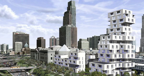
Geospatial tech leader Esri released an updated version of its CityEngine modeling software that is used to generate three-dimensional designs for planning urban environments.
The software supports decision-making surrounding civic planning and design by making it easier to model architectural plans or changes in urban settings.
The software helps create detailed large-scale 3-D city models with a few clicks of the mouse instead of the work-intensive method of object creation and manual placement, Esri said.
Using a “procedural modeling approach,” which automatically generates maps based on a predefined set of rules, planners can explore how changes in the rules or “grammars” might affect or set up new design possibilities.
The latest version, CityEngine 2013, includes a software developer kit (SDK) that enables developers to use CityEngine to create 3-D urban applications using popular 3-D design applications such as AutoDesk Maya, 3dss Max and SketchUp.
The software also has a feature that lets users rapidly import OpenStreetMap data into a project. OpenStreetMap is an open, collaborative project to create a free editable map of the world by gathering mostly free, crowdsourced data.
Another feature in the new version of CityEngine helps developers easily share their work with other users of ArcGIS, Esri’s flagship geospatial information system technology.

~~~~~~~~~~~~~~~~~~~~~~~
Published By
Arka Roy
www.sketchup-ur-space.com
~~~~~~~~~~~~~~~~~~~~~~~
No comments:
Post a Comment